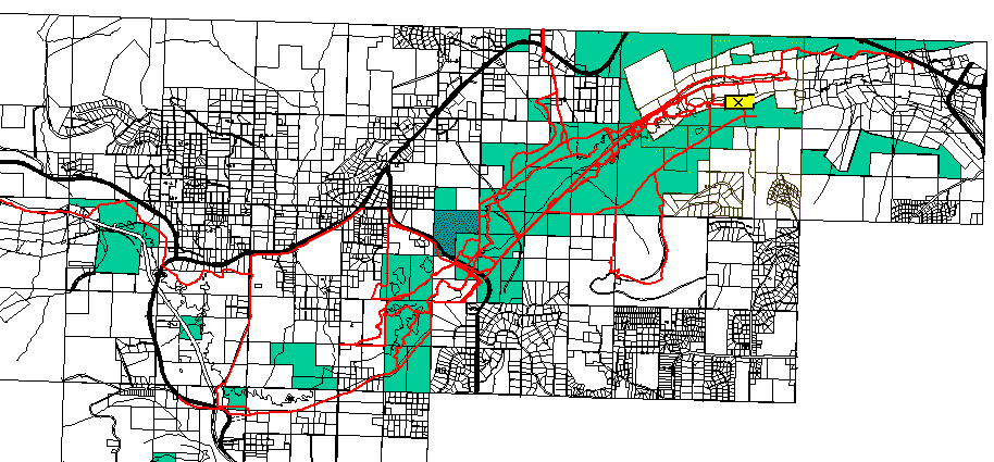
This is a composite image made from Borough basemaps. Properties listed as public (primarily DNR lands) are shaded in green. The property status was obtained from records in the FNSB Property Database. Due to the inherent inaccuracies in putting something like this together, please don't rely on this for any legal questions. It's main purpose is to illustrate how fractured our trail sytem could become in the future. There may be easements or right-of-ways over private property, but those aren't shown here.
This map has been updated as of 3/24/04. There are a few new additions to the public lands since the original was posted in '03. The biggest change is the area marked in dark green (in the center of the map) off Ballaine Rd. The Interior Alaska Land Trust is in the process of purchasing this parcel.